dann würde ich hier am South Tufa Trail jetzt im Wasser stehen bzw. müsste schwimmen – je nach dem wo ich mich gerade befinde. Warum? Weil der Wasserspiegel von Mono Lake zu diesem Zeitpunkt 8 m höher war als heute. Was ist passiert? Nun die Stadt Los Angeles hatte Durst und nach dem Owens Lake weiter südlich leer war, sucht man nach einer neuen Quelle. Ab dem Jahr 1941 wurde das Wasser von vier der fünf Hauptzuflüssen über Aquädukte in die Metropole geleitet, der Wasserspiegel sank, Tiere verschwanden und die bizzaren Tuff-Formationen kamen zum Vorschein. 1982 hatte der See seinen tiefsten Wasserstand 13,70 m unter dem von 1940. 1994 verständigte sich die Stadt Los Angeles mit dem State Water Board und Naturschützern darauf, dass der Wasserspiegel wieder bei 1948 m Meereshöhe liegen soll und nur aufgrund natürlicher Schwankungen weniger sein darf. Die Wiederherstellung begann.
English Summary
If we had had the year 1940
then at the South Tufa Trail I would be standing in water or I had to swim. Why? Because at that time the water level of Mono Lake was about 26 ft higher than today. What had happened? The city of Los Angeles was thirsty and after using up all the water from Owens Lake further south they had been looking for another water source. So beginning in 1941 the water of four of five major tributaries was send to Los Angeles in an aqueduct. The water level sank, animals left the area and the tufa formations came to the surface. In 1982 Mono Lake reaches its historic low level 45 ft under the one of 1940. In 1994 the city, naturalists and the State Water Board agreed to a new mainly constant water level at
6392 ft above sea level. The restauration of the lake began.
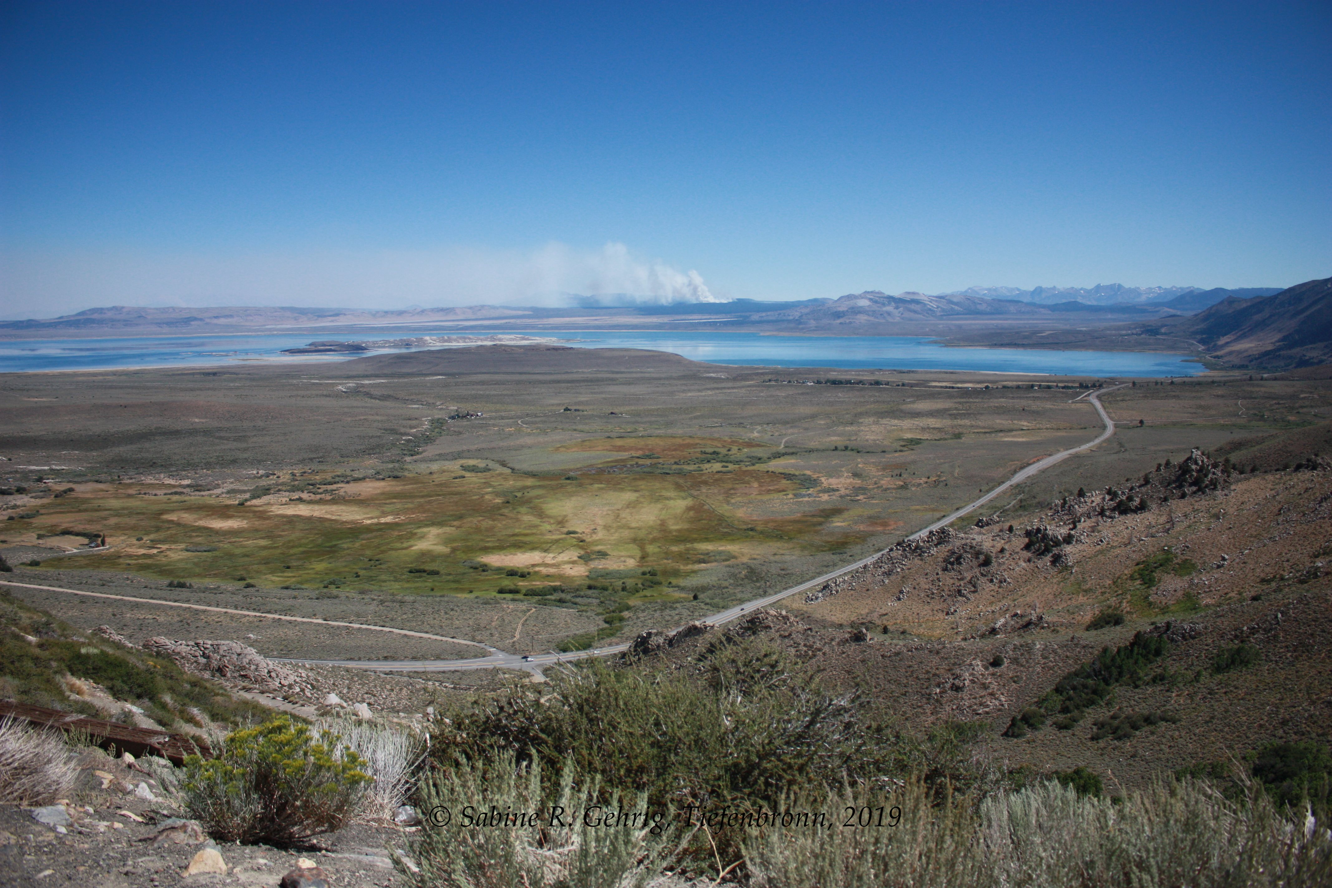
Blick auf Mono Lake, CA von einem Aussichtspunkt an der US 395 aus, im Hintergrund steigt die Rauchsäule eines Waldbrandes auf / View of Mono Lake taken from a vista point at US 395, in the background a smoke column from a wildfire could be seen
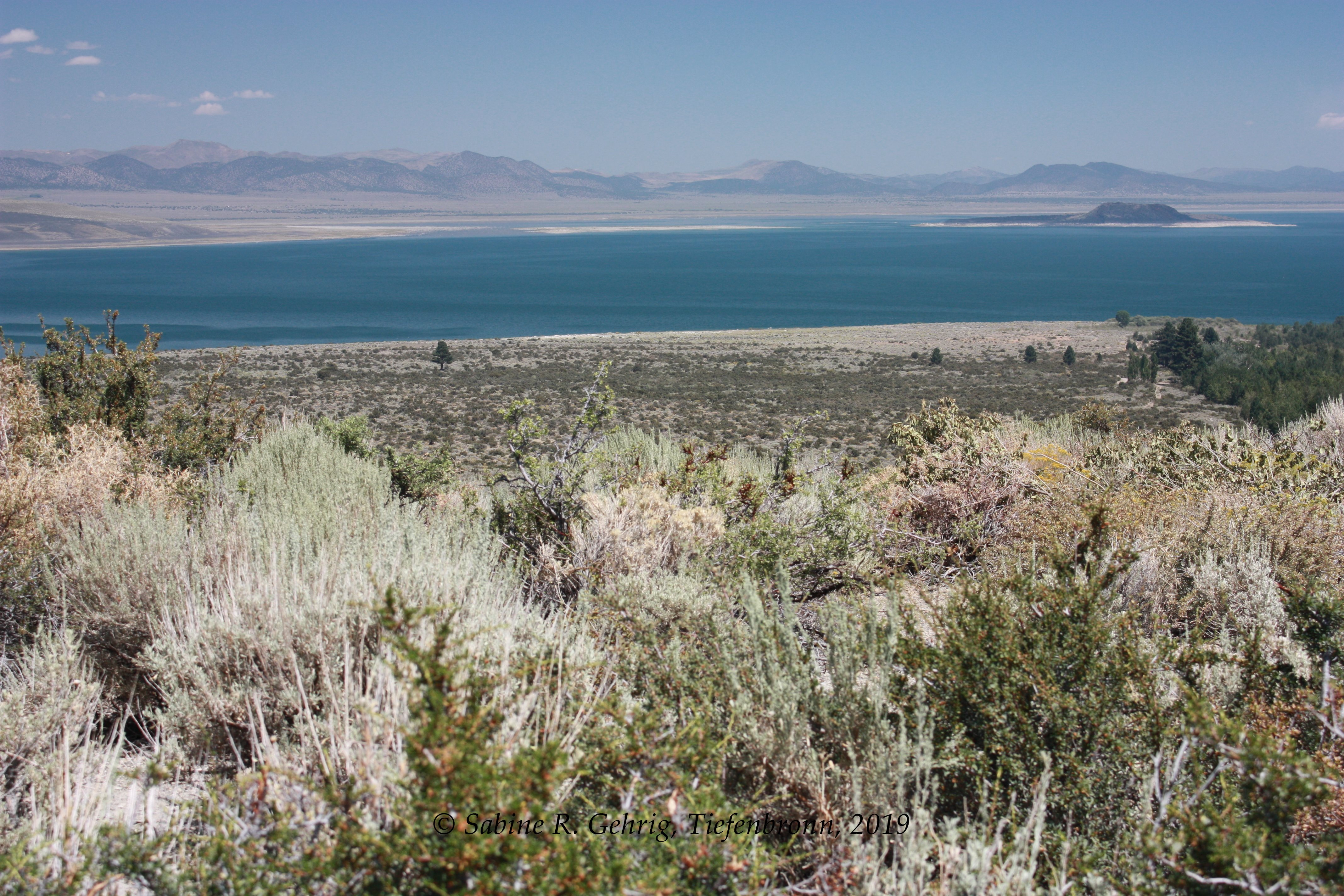
Mono Lake, CA – Blick auf die Vulkaninsel Negit Island und die Landbrücke nach Norden / view of the volcanic Negit Island and the land bridge to the North
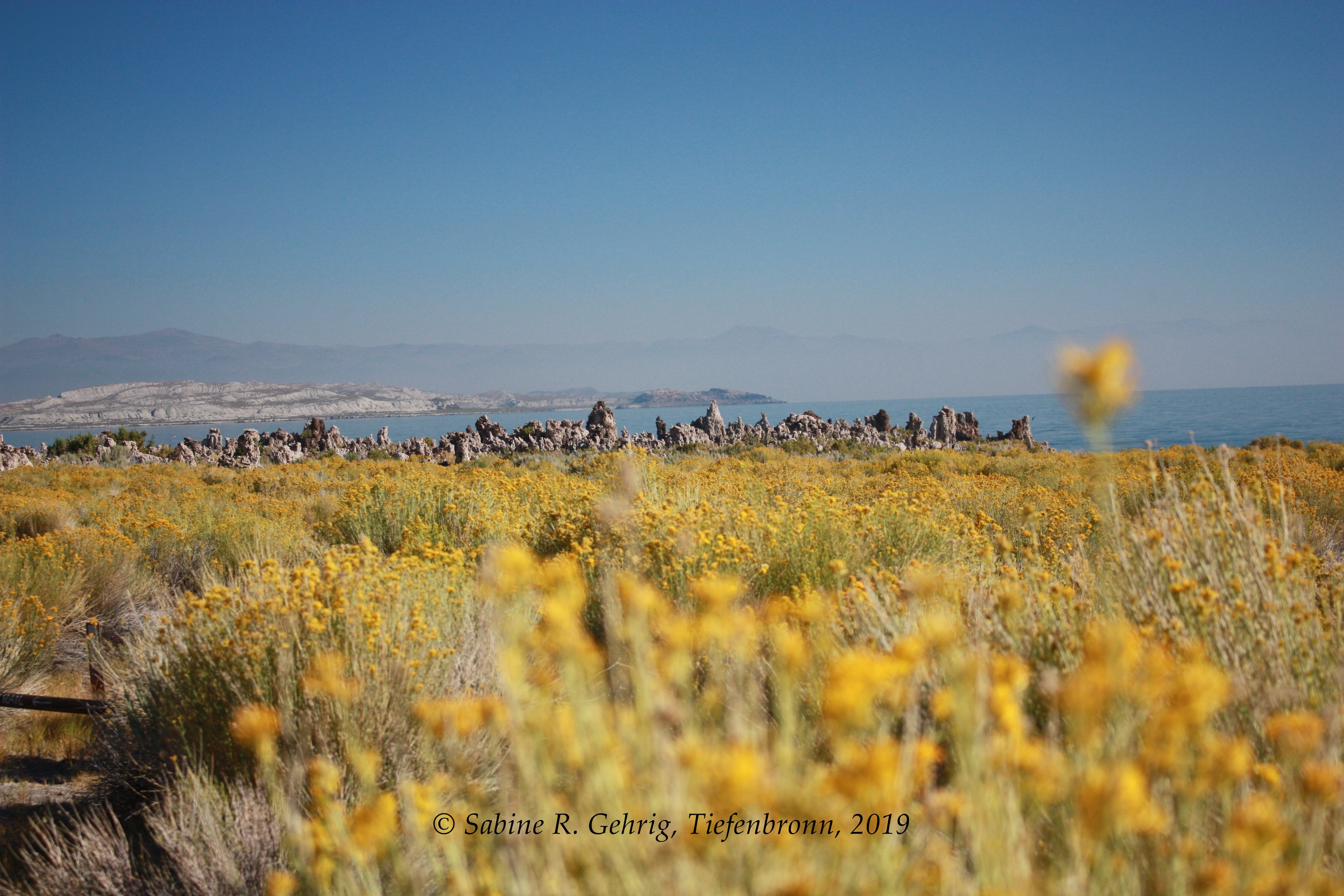
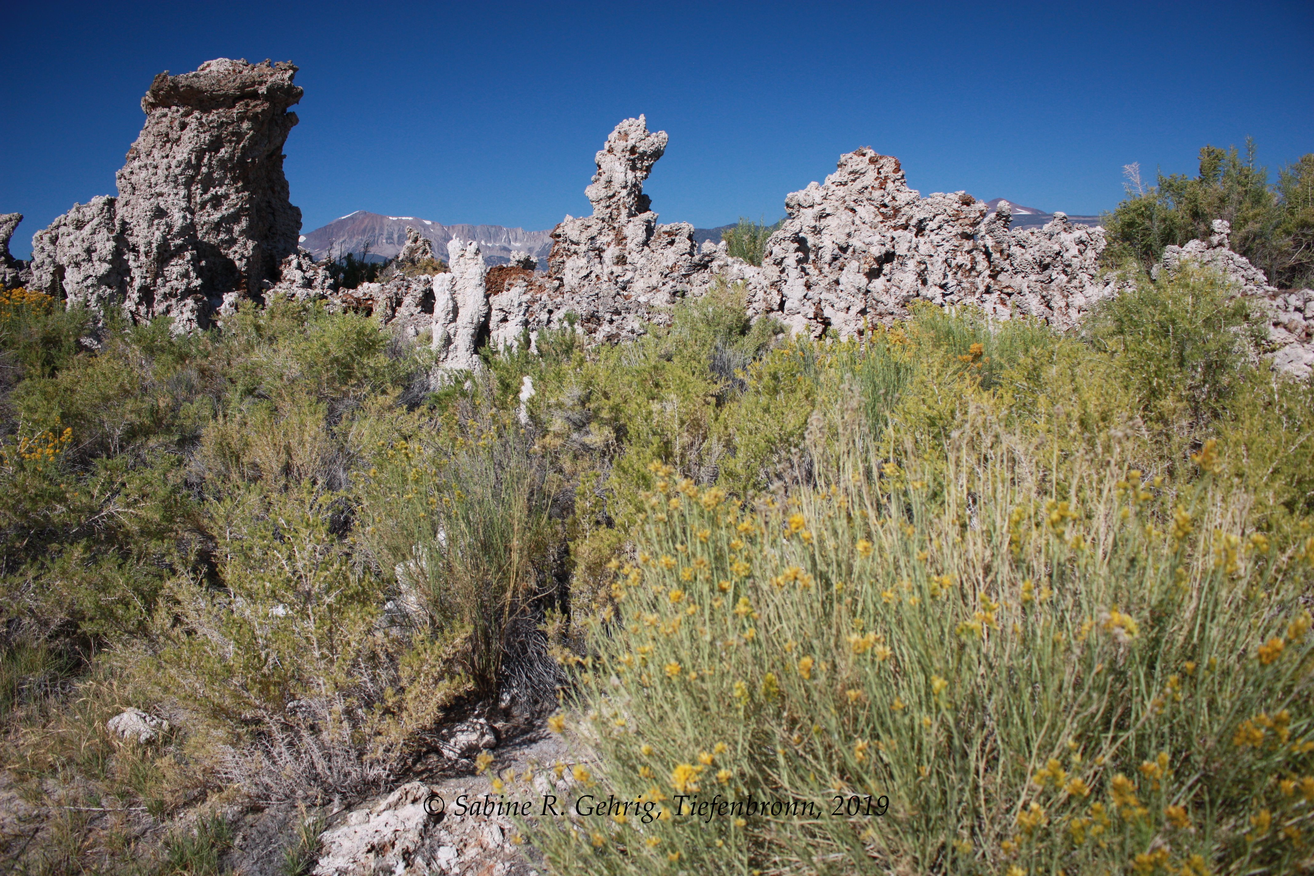
Mono Lake, CA – South Tufa Trail: blühender Rabbitbrush und Tufaformationen in der Ferne / blooming Rabbitbrush and tufa formation
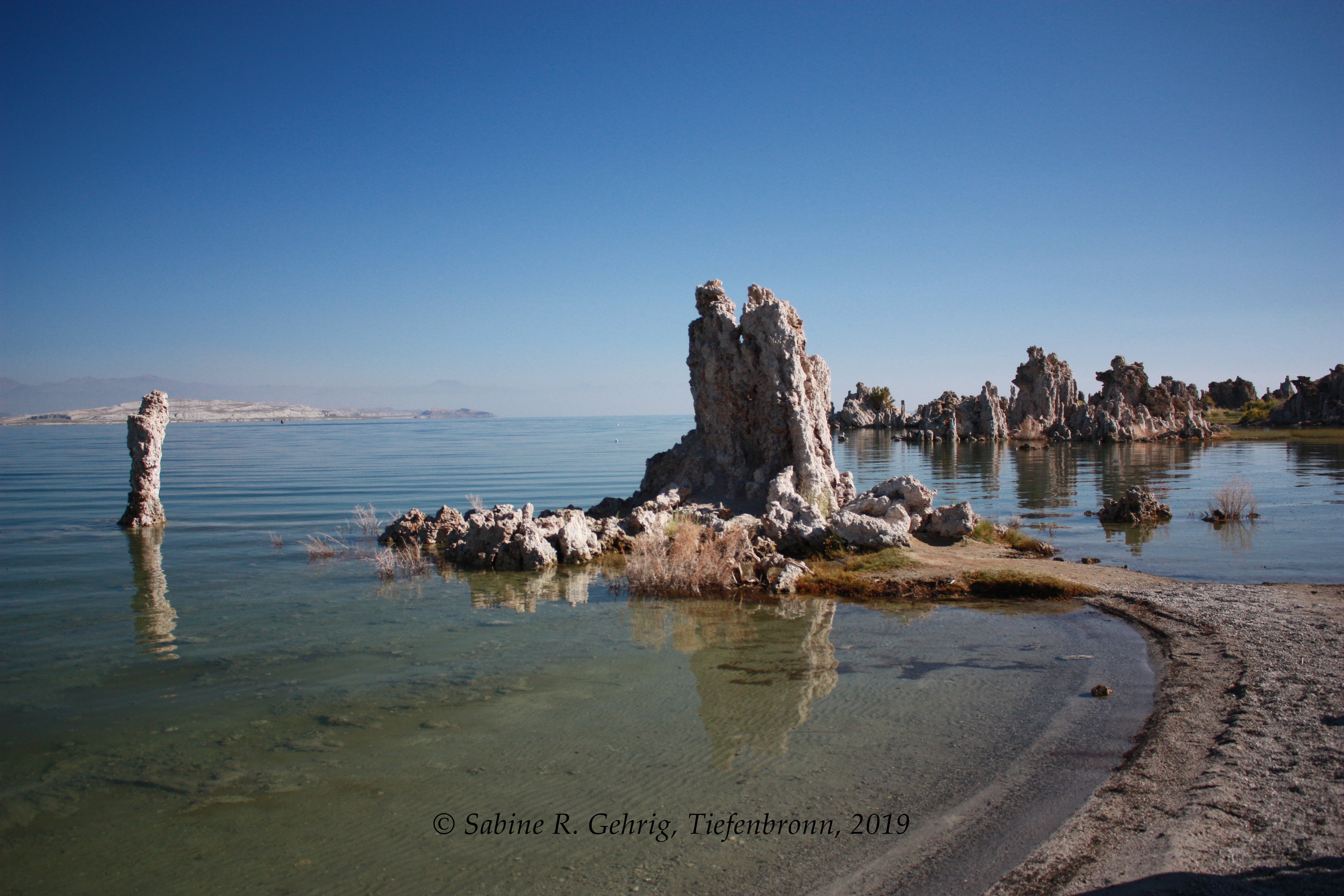
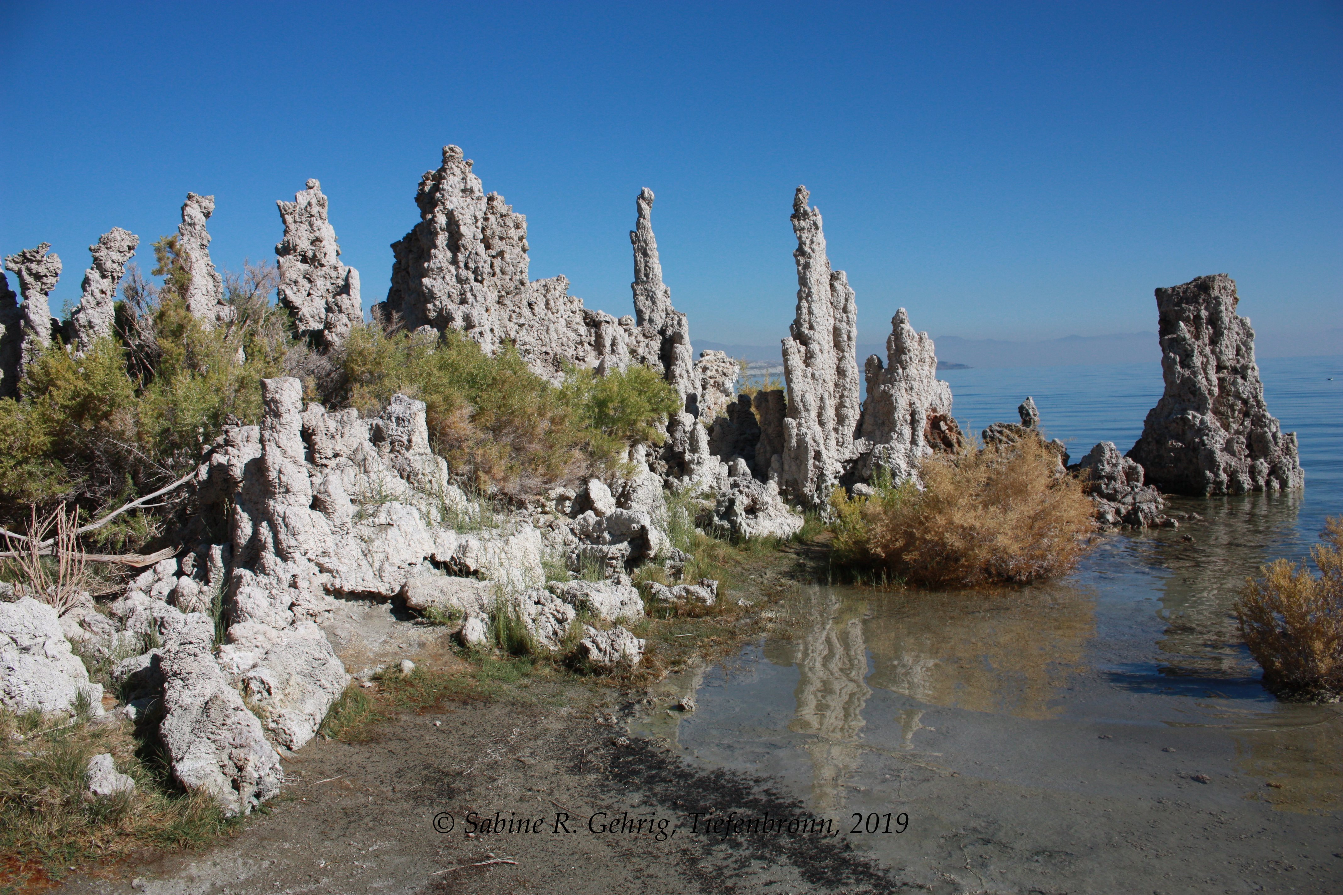
Mono Lake, CA – South Tufa Trail: Tufa am Ufer mit Blick nach Nordosten / tufa at the shore facing Northeast
Mono Lake, CA – South Tufa Trail: Tufa einmal näher / a closer look of the tufa
Mono Lake, CA – South Tufa Trail: Tufa, das Schwarze im Vordergrund direkt am Ufer sind unzählige kleine Fliegen, die Nahrungsgrundlage für Vögel / Tufa; the black area directly at the shoreline are flies an important food source fort he birds
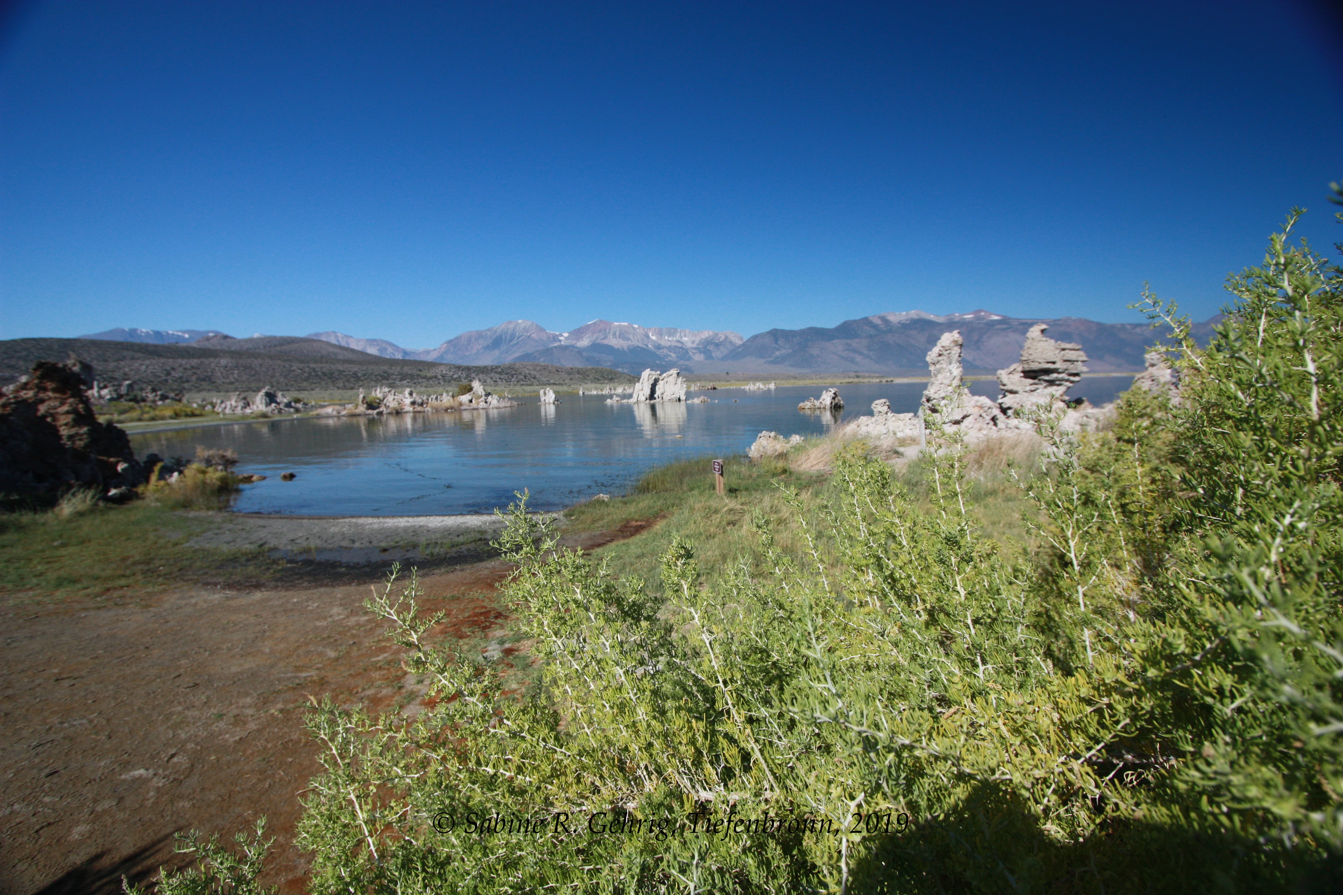
Mono Lake, CA – South Tufa Trail: Tufa mit der Range der Sierra Nevada im Hintergrund / Tufa with the Sierra Nevada Range in the background
Very nice,it’s an interesting place!
Jerry