Das war die Feststellung der Rangerin im Visitor Center des Natural Bridges National Monument bei meinem Besuch 2009. Es hatte in der Region seit Monaten nicht geregnet. Dafür jetzt schon die ganze Fahrt hierher – mal weniger, mal mehr Regen. Das gibt der grandiosen Landschaft einen besonderen Reiz. Leider rät man uns von Wanderungen zu den Steinbrücken ab, da der glatte Fels jetzt sehr rutschig ist.
Wie entstanden diese Steinbrücken?
- Voraussetzung ist, dass ein Fluss durch eine Gesteinsschicht fließt, in der das Wasser leicht den ‚Zement’ zwischen den Sandkörnern lösen kann.
- Wenn der Fluss jetzt Mäander, also große Schleifen, bildet, dann kommt irgendwann der Zeitpunkt, an dem Beginn und Ende der Flussschleife nur noch durch eine dünne Felswand voneinander getrennt sind.
- Wenn jetzt z. B. eine Sturzflut kommt, kann die noch vorhandene Wand schnell zerstört werden. Der Fluss fließt dann auf direktem Weg. Das Wasser und die weitere Verwitterung vergrößern den Durchlass bis die Brücken richtig zu sehen sind.
English Summary
Finally it rained after months
This was the ranger’s statement in the Visitor Center of the Natural Bridges National Monument while I visited the park in 2009. It hadn’t rained in the area for months. But since we left Torrey in the morning it rained – sometimes less, sometimes more. This makes the grand landscape very special. Unfortunately we are advised not to hike to the stone bridges, because the smooth rock is very slippery now.
How did the stone bridges develop?
- A prerequisite is that a river flows through a layer of rock in which the water can easily dissolve the ‚cement‘ between the grains of sand.
- If the river now forms meanders, i.e. large loops, then at some point the time is come when the beginning and end of the river loop are separated from each other only by a thin rock wall.
- If a flash flood occurs, the remaining wall can be destroyed quickly. The river then flows in a direct way. The water and further weathering increase the passage until the bridges can be seen properly.
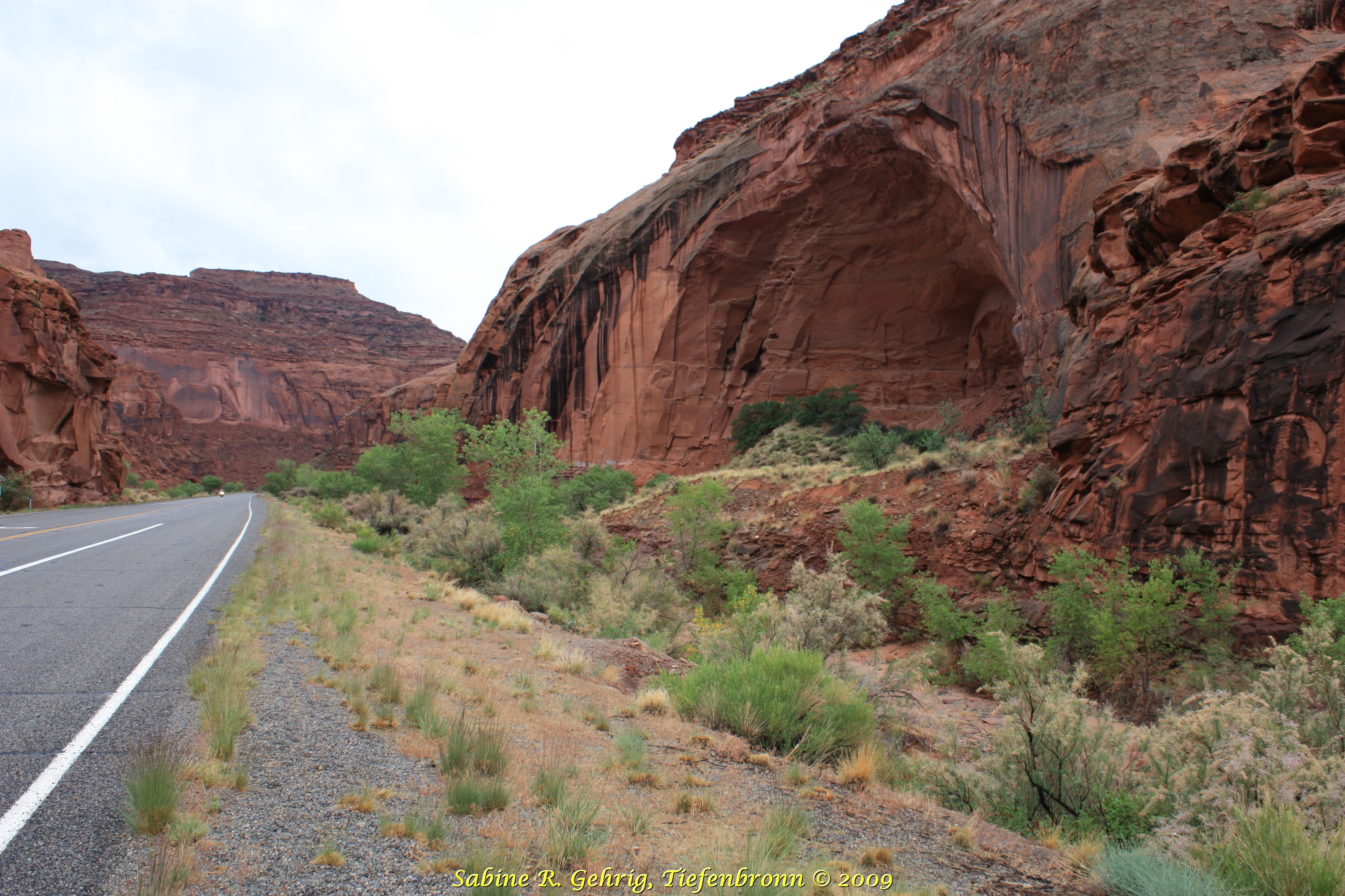
UT 95 South – Fahrt durch den North Wash auf dem Weg zum Lake Powell / Driving through North Wash on the way to Lake Powell
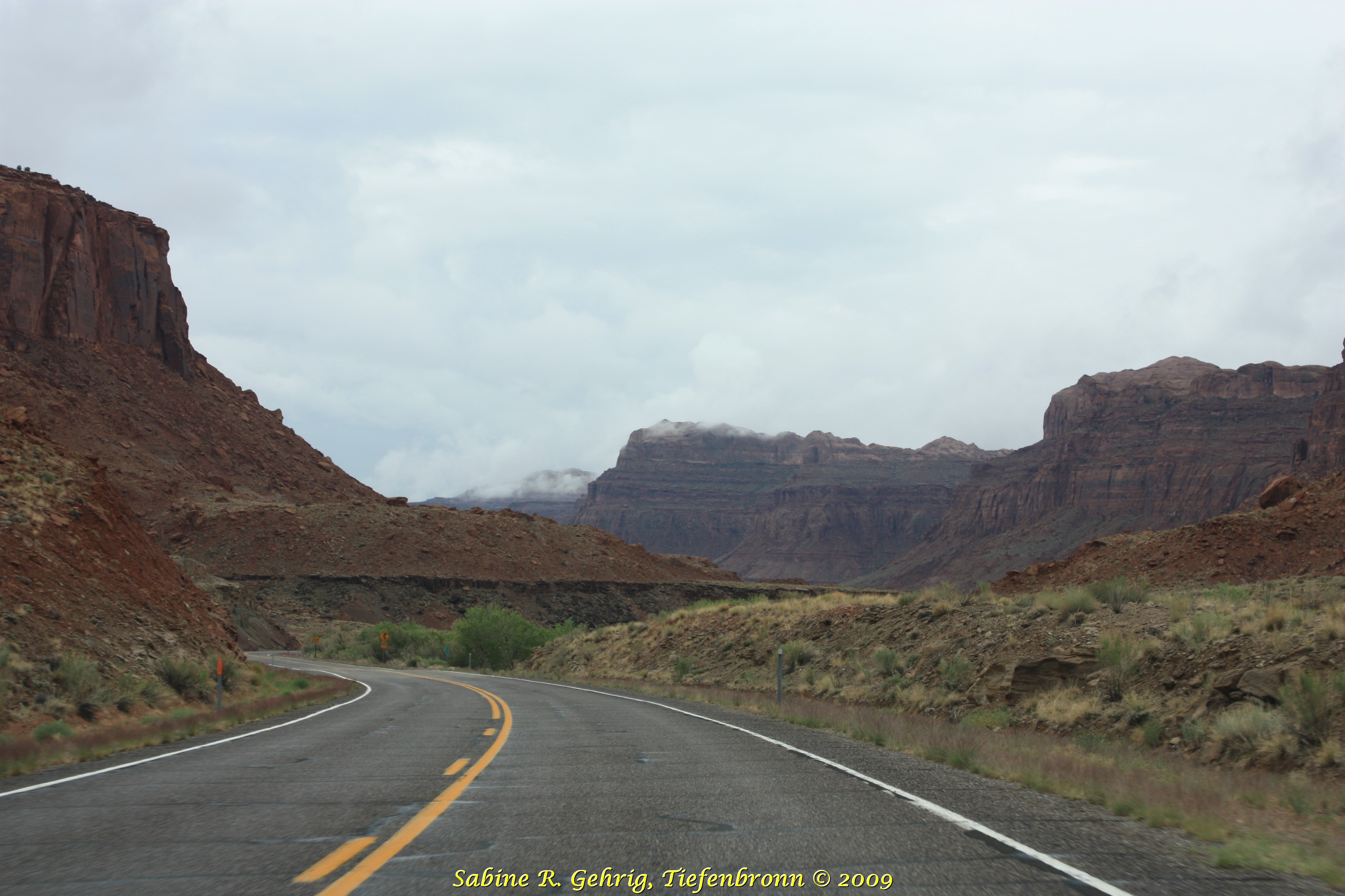
UT 95 South – Fahrt durch den North Wash, schon etwas näher am Lake Powell / Still driving through North Wash even closer to Lake Powell
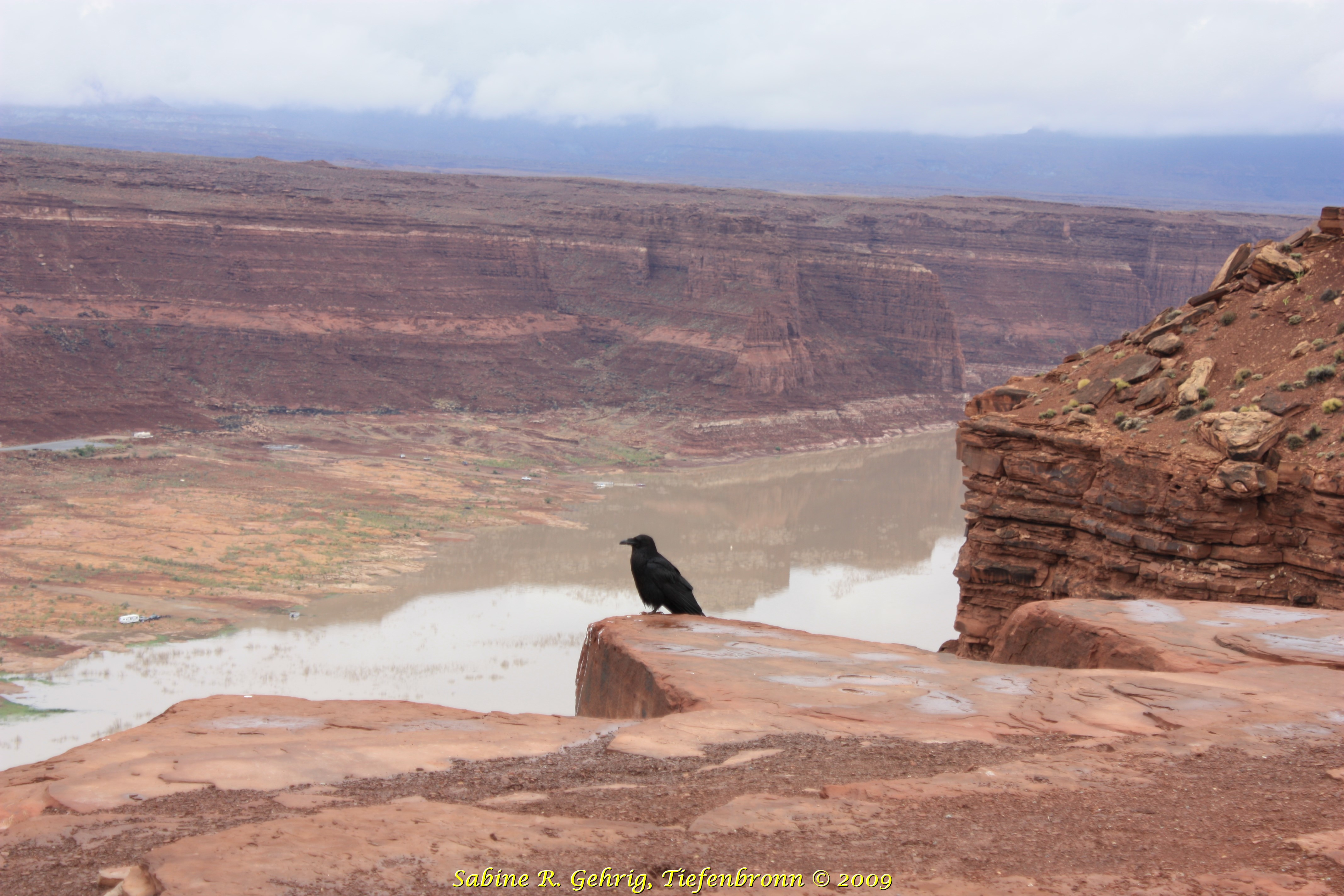
Lake Powell, UT – das nördliche Ende des Stausees; der Rabe hält Wacht; auf der anderen Seite lag unten am Fluss der heute überflutete Ort Hite / the northern end of the reservoir; the raven is keeping watch; on the other side lies the flooded ghost town Hite
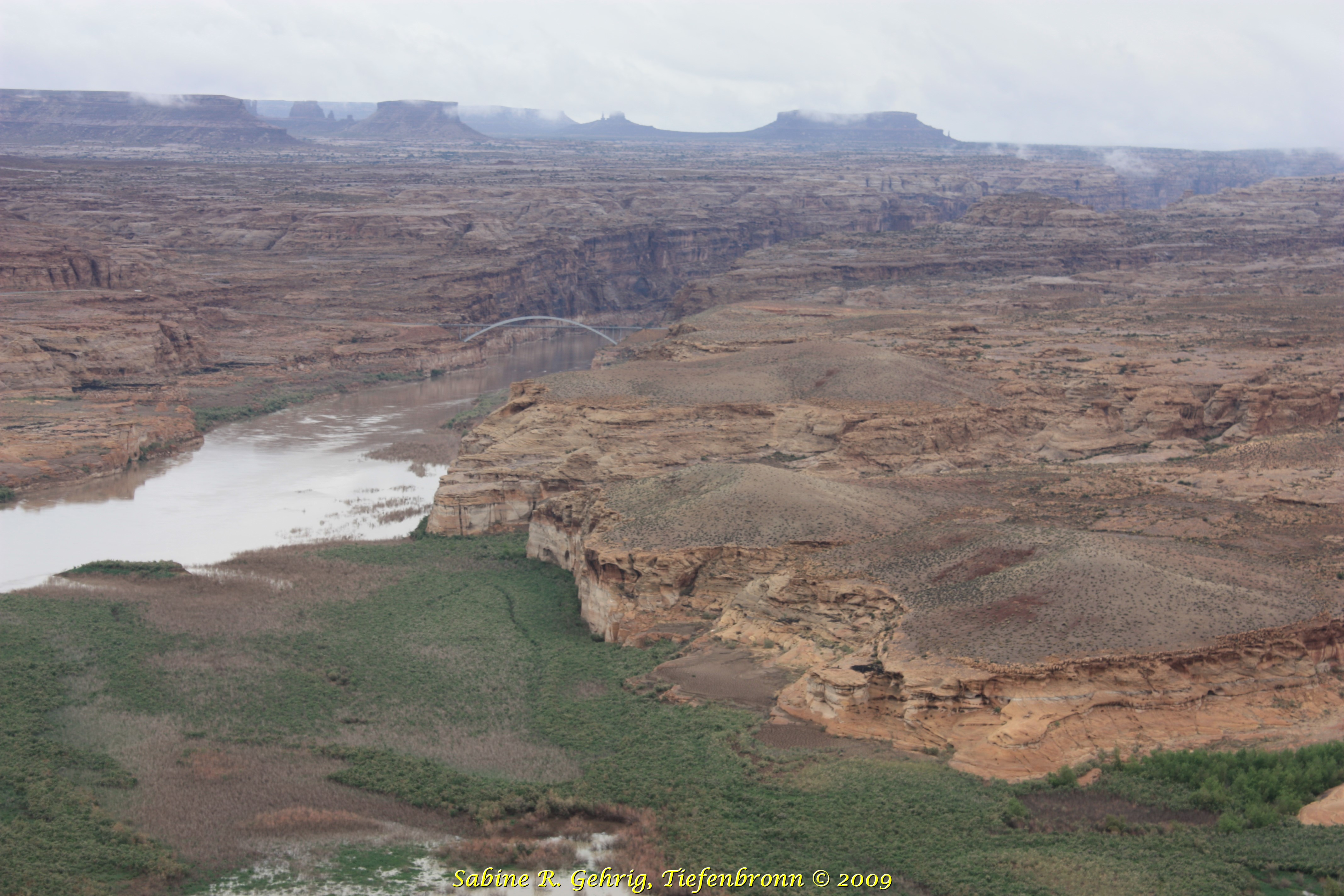
UT 95 – Brücke über den Colorado River bei Hite / Hite Crossing Bridge
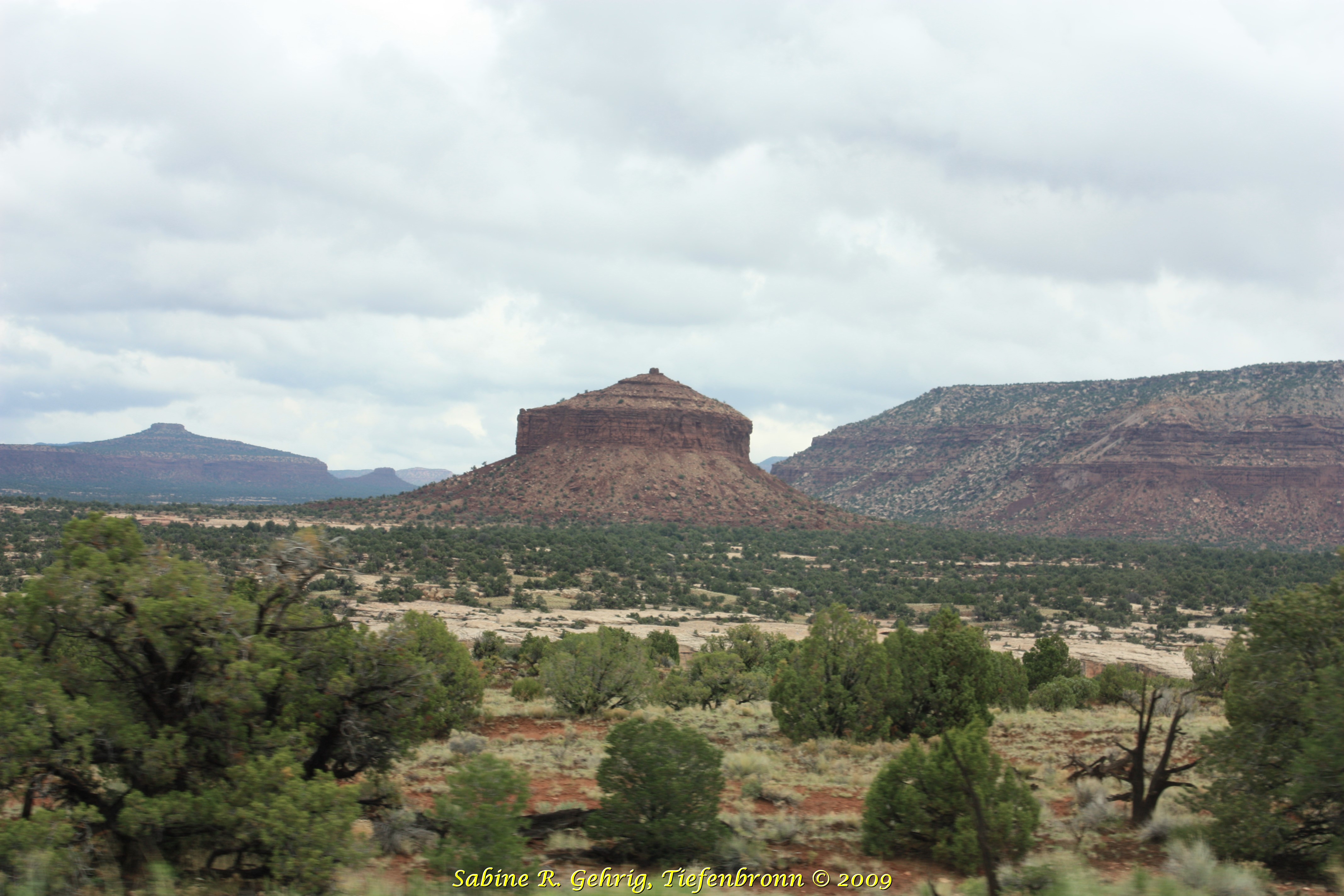
UT 95 South – ein markanter Fels, genannt Käseschachtel / a prominent rock, called Cheese Box Butte
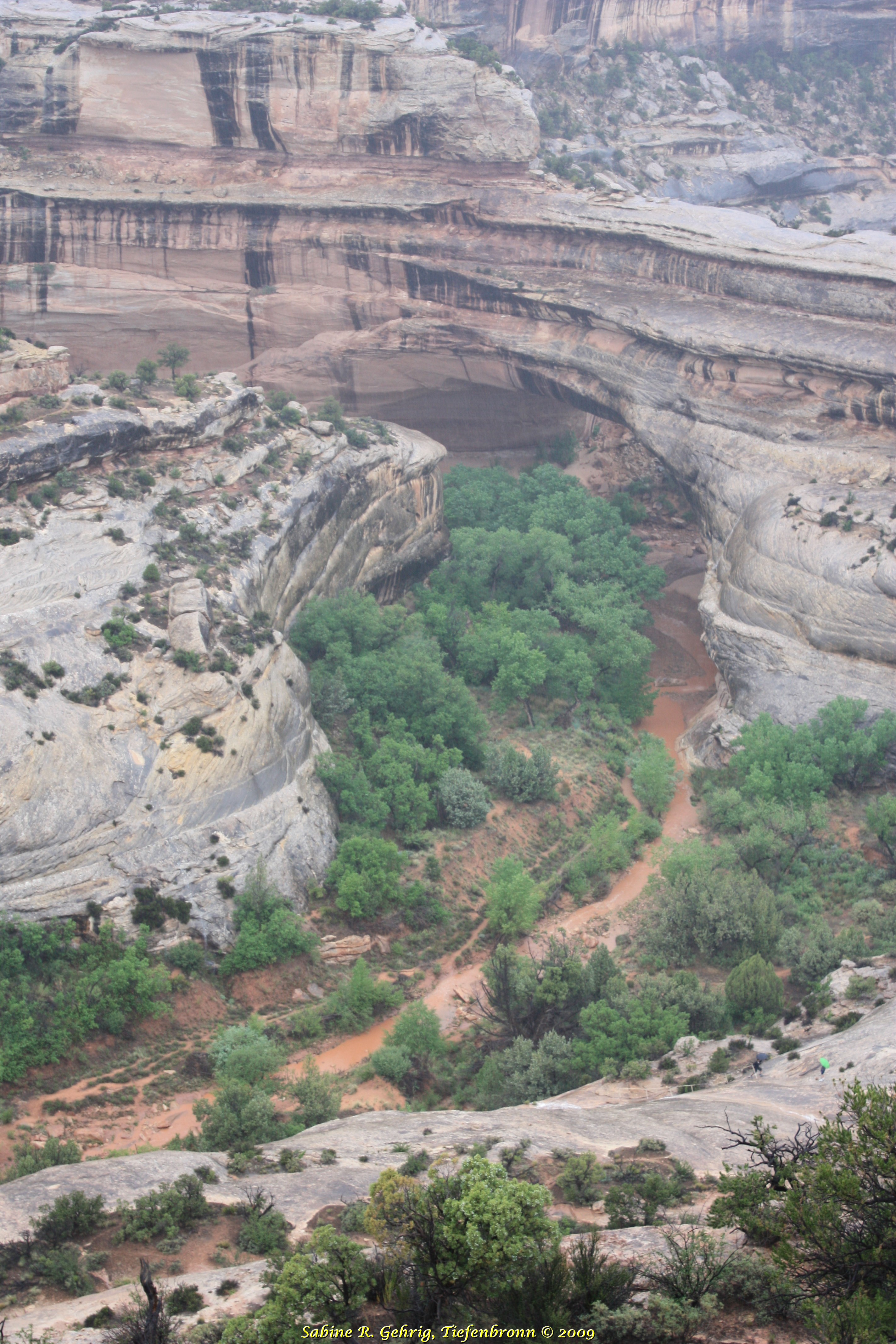
Natural Bridges National Monument, UT – Kachina Bridge: die jüngste Brücke, sie hat den dicksten Bogen; Höhe 64 m, Größe der Öffnung 62,2 m, Breite 13,4 m und Dicke des Bogens 28,3 m / the youngest bridge, it has the thickest arch; height 210 ft, size of the opening 204 ft, width 44 ft and thickness of the arch 93 ft
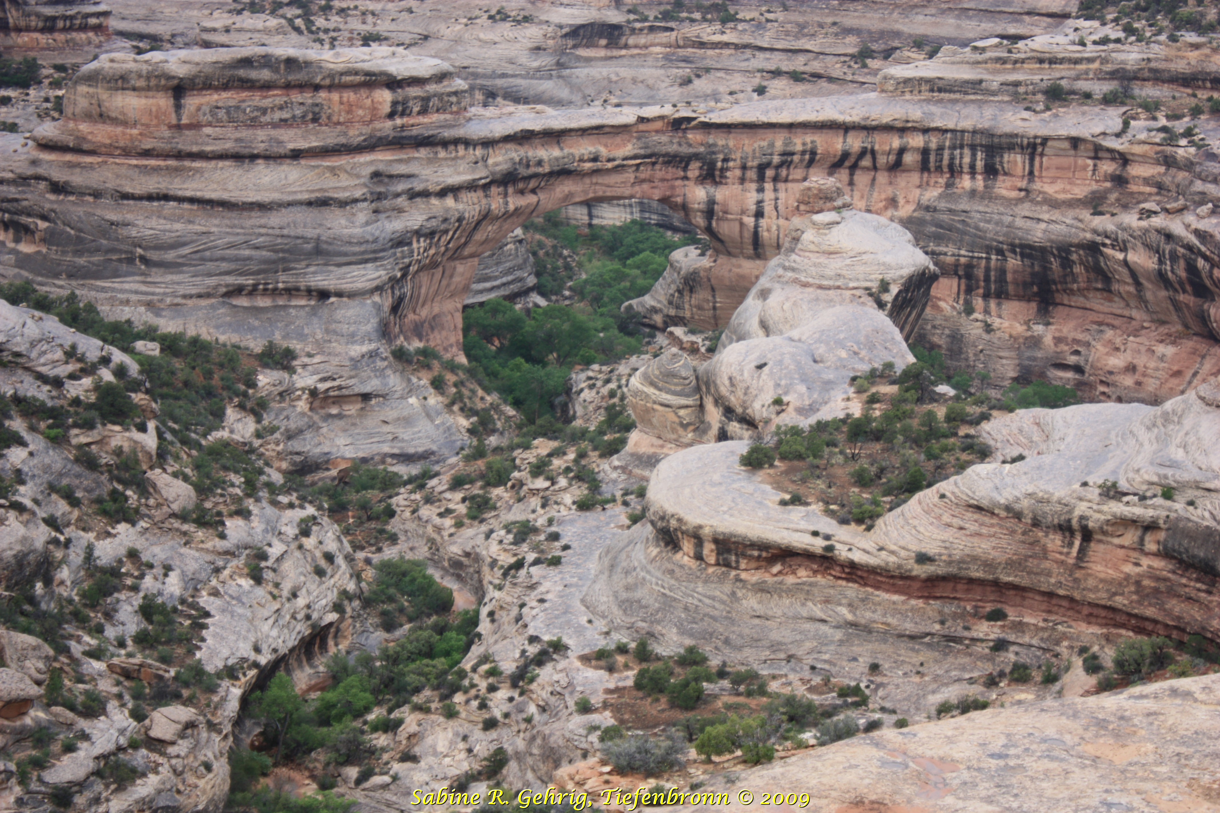
Natural Bridges National Monument, UT – Sipapu Bridge: die zweitjüngste Brücke; Angaben zur Brücke: Höhe 67,1 m, Größe der Öffnung 81,7 m, Breite 9,5 m und Dicke des Bogens 16,2 m / the second youngest bridge; information about the bridge: height 220 ft, size of the opening 268 ft, width 31 ft and thickness of the arch 53 ft
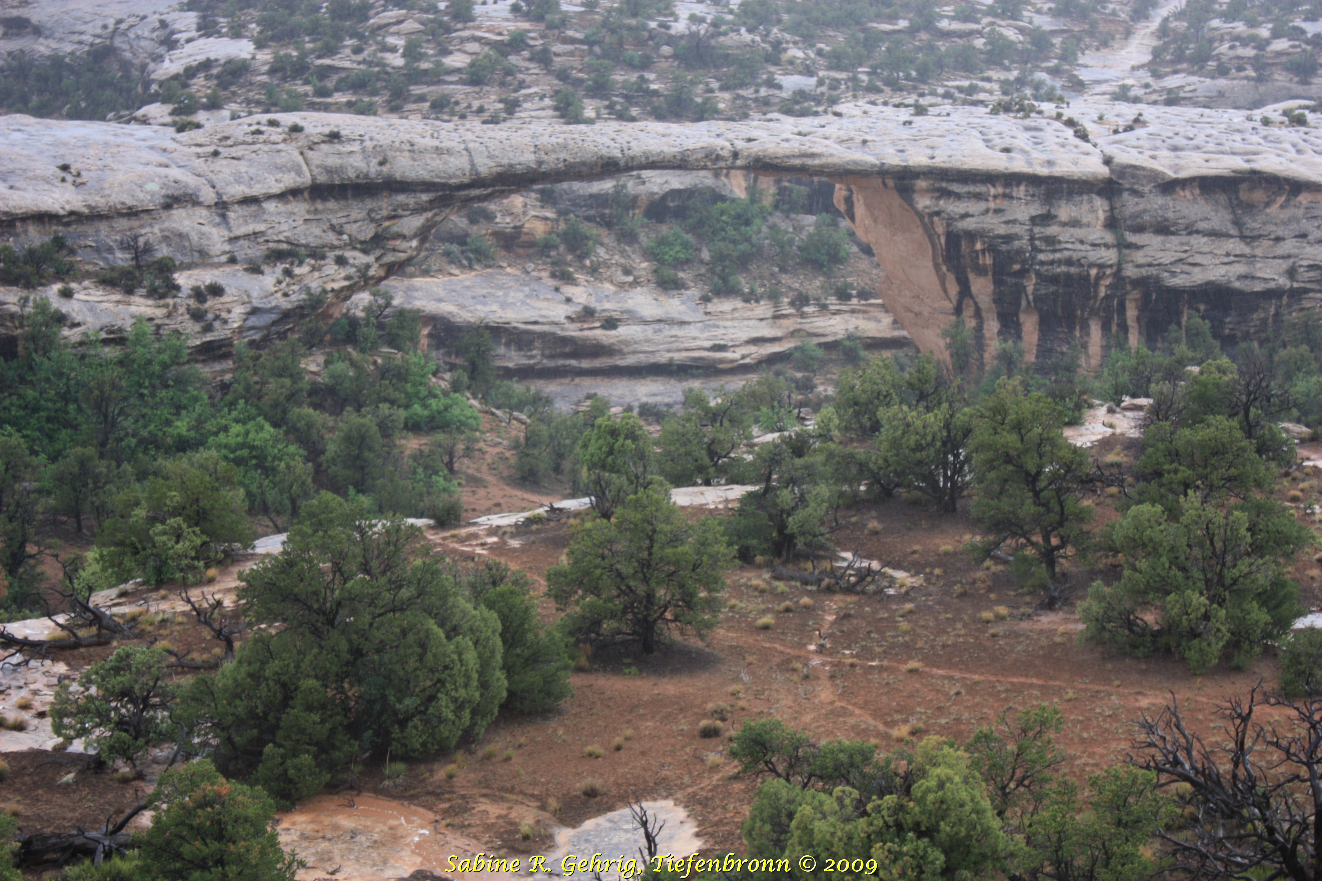
Natural Bridges National Monument, UT – Owachomo Bridge: die älteste Brücke, sie hat den dünnsten Bogen; Höhe 32,3 m, Größe der Öffnung 54,9 m, Breite 8,3 m und Dicke des Bogens 2,7 m / the oldest bridge, it has the thinnest arch; height 106 ft, size of the opening 180 ft, width 27 ft and thickness of the arch 9 ft
Very nice Sabine, even if the weather wasn’t ideal back then.
Don’t feel bad, I was there years ago and didn’t get to hike there either except my excuse was just not having the time to do it.
I hope you are doing well!
Take Care!
Jerry