Akt 1: Sedimentation
Durch Wind und Wasser wird an anderer Stelle abgetragenes Gesteinsmaterial ins Gebiet des National Park transportiert und abgelagert. Der erste Akt dauert meist einige Millionen Jahre und wechselt sich immer wieder mit dem zweiten Akt ab.
Akt 2: Verfestigung
Durch den Eintrag von Calciumcarbonat und durch enormen Druck wird das lockere Material verfestigt. Auch dieser Akt dauert sehr, sehr lange und wechselt sich mit dem ersten Akt ab, bis es dann endlich weitergeht mit
Akt 3: Hochheben
Die Pazifische Platte tauchte immer mit 30° Neigung unter den nordamerikanischen Kontinent. Aus irgendeinem Grund verändert sich vor Jahrmillionen dieser Neigungswinkel und wird spitzer, also kleiner. Dies hat zur Folge, dass das gesamte Colorado Plateau um ca. 1.524 m angehoben wird.
Akt 4: Erosion
Nach dem das Gelände so exponiert ist, kann der letzte Akt beginnen – und dieser Akt wird immer noch gespielt. Wind, Wasser und Frost als Erosionskräfte nagen an den Felsen, machen sie brüchig und tragen sie letztendlich ab, transportieren sie über Bäche in die Flüsse und von dort weiter – leider in einen Stausee und nicht wie früher bis ins Meer. Und dann beginnt wieder der erste Akt gefolgt vom zweiten.
So unterhaltsam erklärt der Ranger die geologischen Vorgänge, die sich seit Jahrmillionen hier abspielen und diese großartige Landschaft immer noch formen – Island in the Sky im Canyonlands National Park. Kommt mit und seht selbst. (2009)
English Summary
A play in four acts
Act 1: Sedimentation
Wind and water transport and deposit rock material eroded elsewhere in todays National Park area. The first act usually lasts several million years and alternates again and again with the second act.
Act 2: Consolidation
The loose material is solidified by the introduction of calcium carbonate and by enormous pressure. This act also takes a very, very long time and alternates with the first act until it finally continues with the
Act 3: Lifting
The Pacific Plate always dived with 30° inclination under the North American continent. For some reason, millions of years ago, this inclination changed and became more acute, i.e. smaller. As a result, the entire Colorado Plateau is elevated by about 5,000 ft.
Act 4: Erosion
After the area is exposed, the last act can begin – and this act is still playing in our days. Wind, water and frost as erosion forces gnaw away at the rocks, making them brittle and removing them, transporting them via streams into the rivers and further on – unfortunately into a reservoir and not, as in the past, into the sea. And then the first act begins again, followed by the second and so on.
This is how entertainingly the ranger explains the geological processes that have been taking place here for millions of years and that still shape this magnificent landscape – Island in the Sky in Canyonlands National Park. Join me to explore this „island“. (2009)
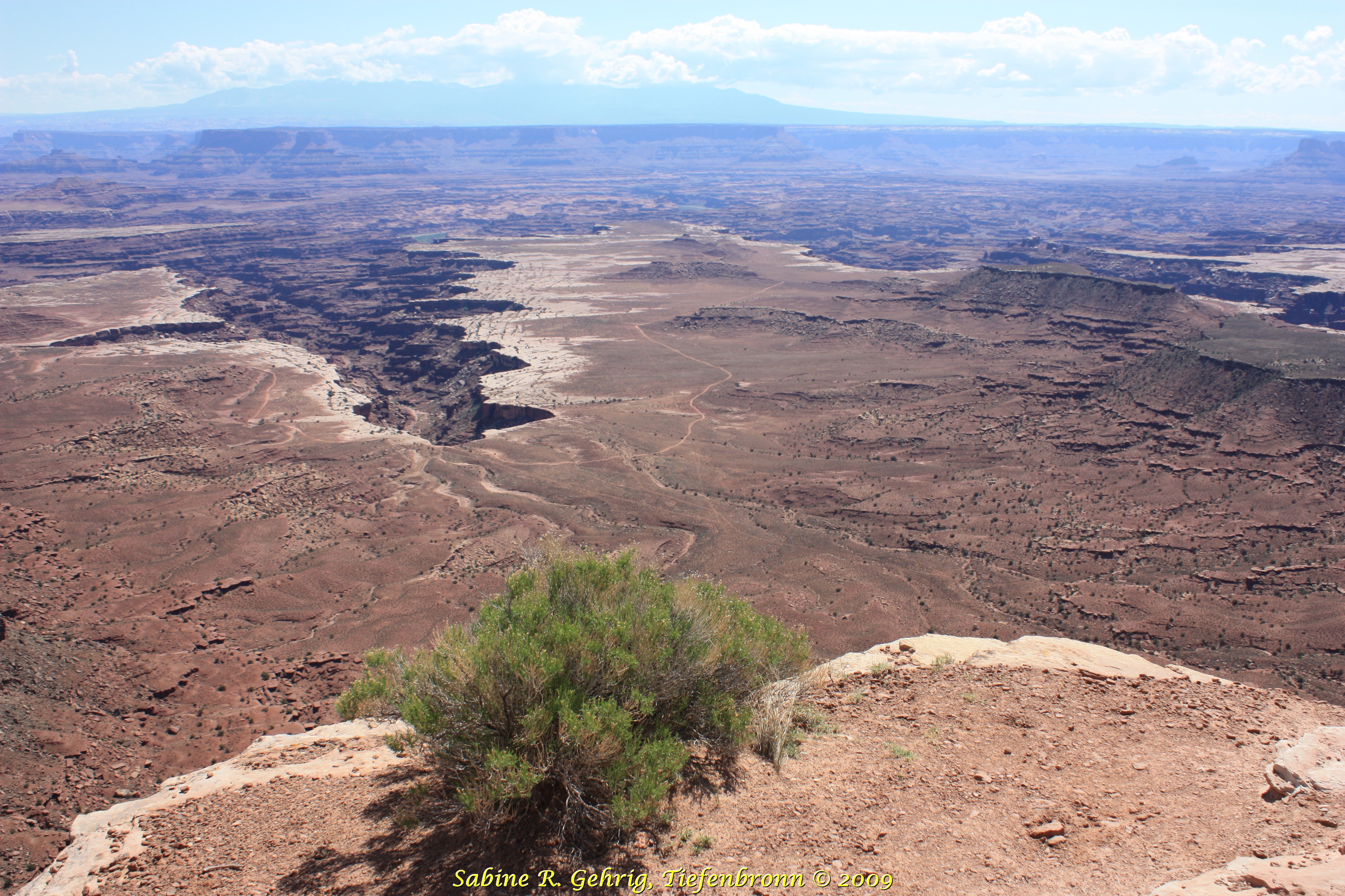
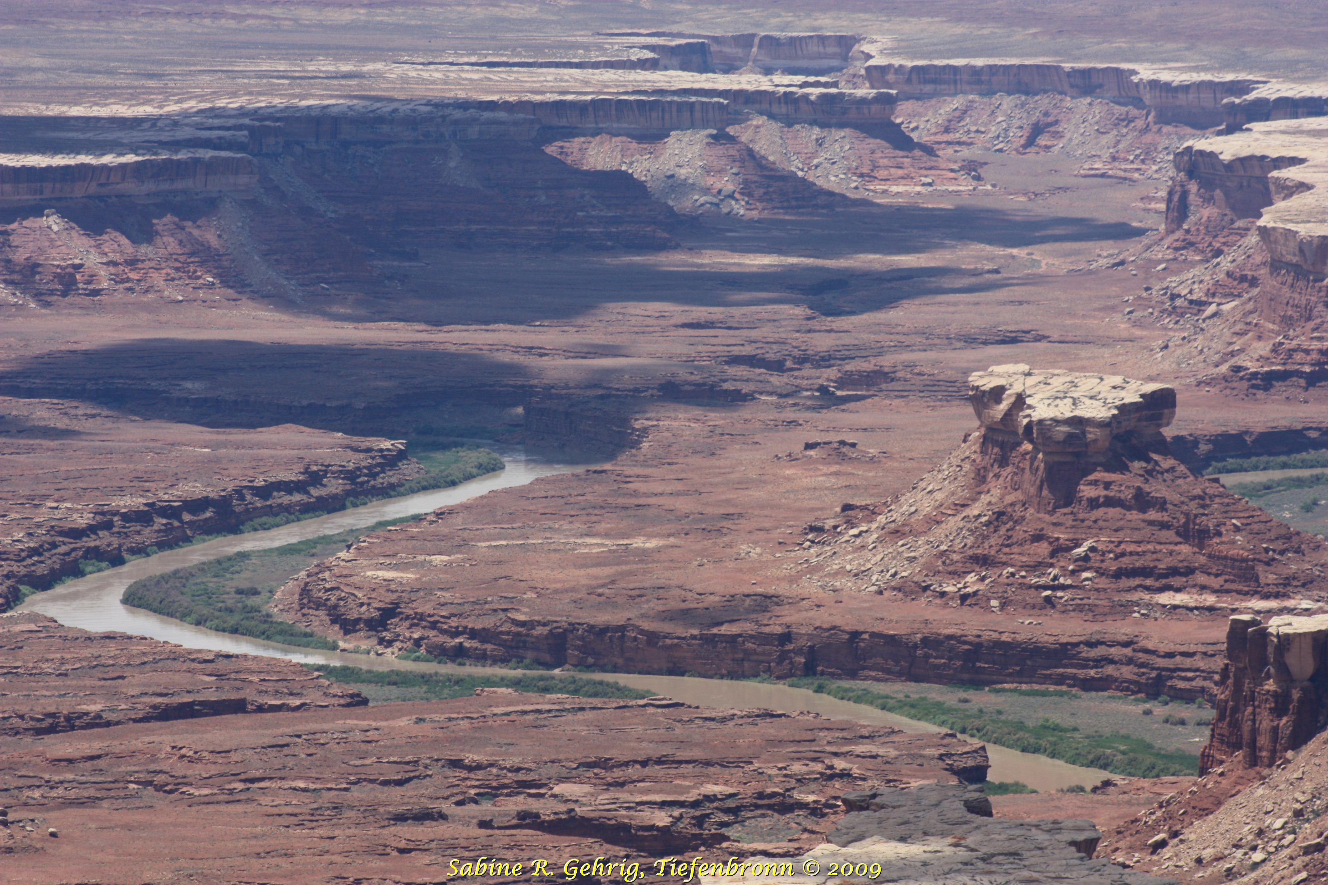
Canyonlands National Park, Island in the Sky, UT – Buck Canyon Overlook mit weitem Blick hinunter zum White Rim und zum Colorado River; am Horizont sind die La Sal Mountains zu erkennen. Dem White Rim kann man mit einem geländegängigen Fahrzeug 100 mi/161 km lang folgen. Doch wie kommt man da runter? / Buck Canyon Overlook with a wide view down to the White Rim and the Colorado River; the La Sal Mountains can be seen on the horizon. The White Rim can be followed with an off-road vehicle for 100 mi/161 km. But how to get down there?
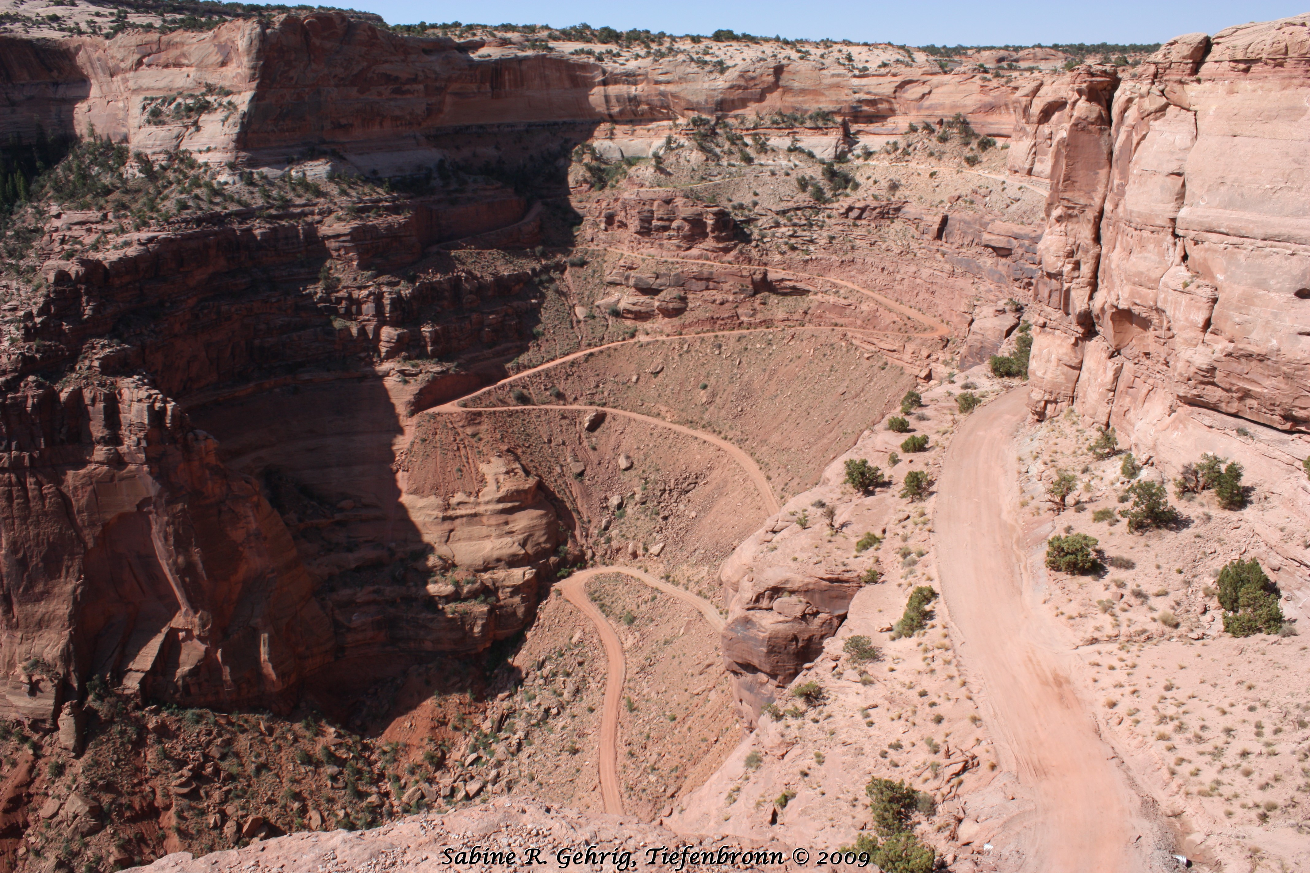
Canyonlands National Park, Island in the Sky, UT – Der abenteuerliche Weg führt über die Shafer Trail Road 427 m zum White Rim. In den 50er Jahren wurde der Trail verbreitert, damit Lkw uranhaltiges Gestein abtransportieren konnten. / The adventurous route leads along the Shafer Trail Road 1,400 ft to the White Rim. In the 1950s, the trail was widened to allow trucks to transport uranium-bearing rock.
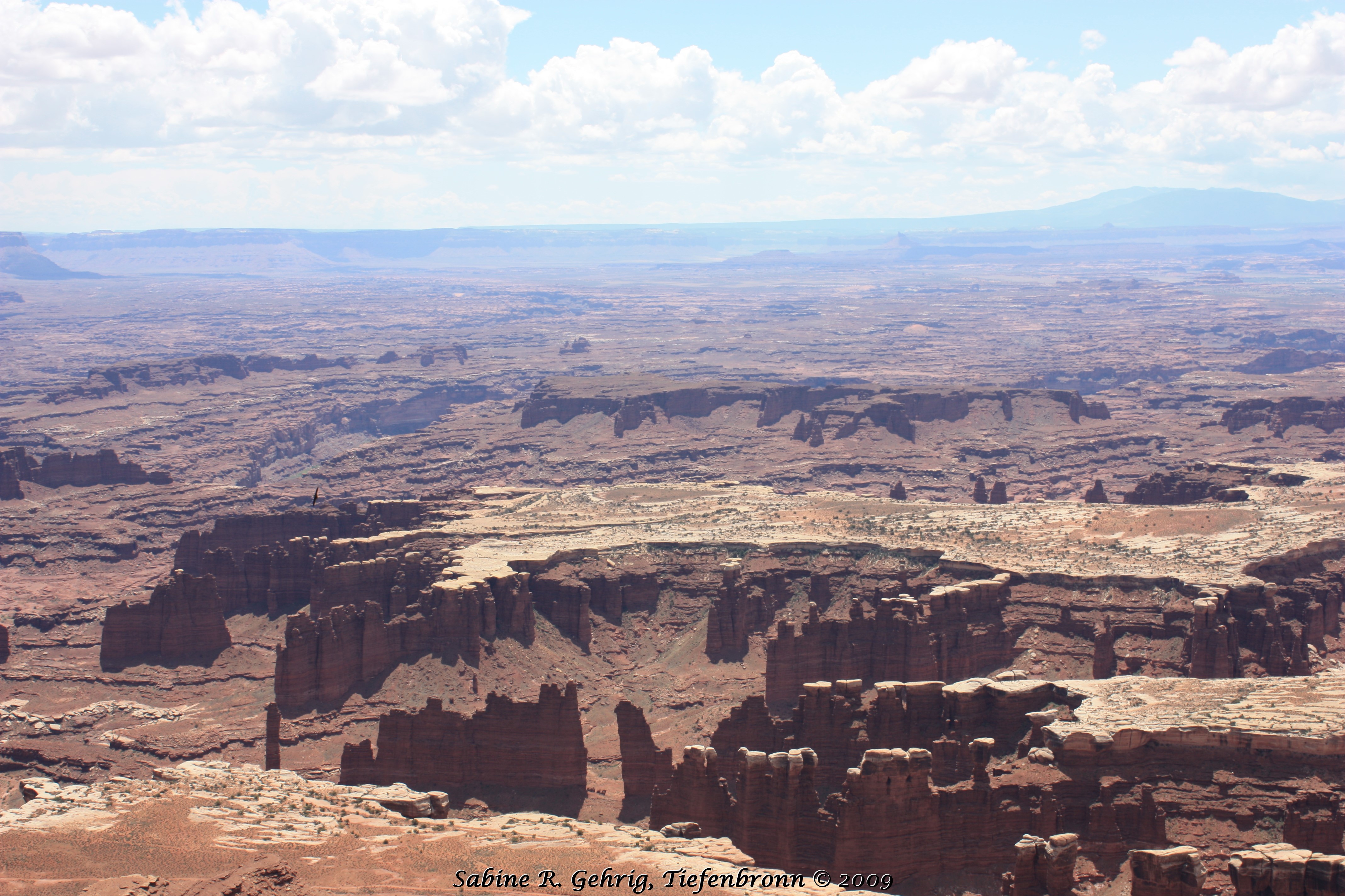
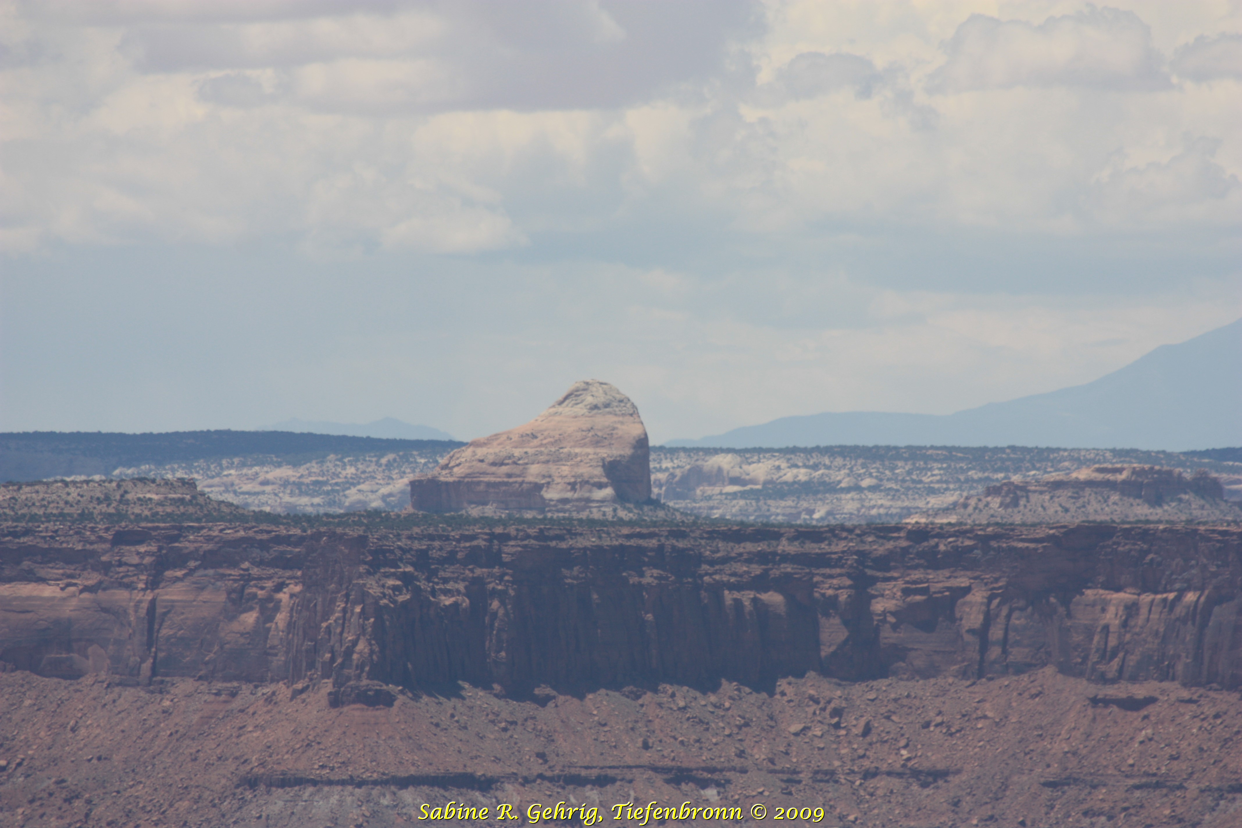
Canyonlands National Park, Island in the Sky, UT – Blick vom Grand View Point nach Süden zu den Henry Mountains. Die Felsnadeln mit weißen Spitzen im Vordergrund nannte der Ranger ‘Chocolate-Vanilla-Hoodoos‘. / View from Grand View Point south to the Henry Mountains. The rock needles with white caps in the foreground are called ‚Chocolate-Vanilla-Hoodoos‘ by the ranger.
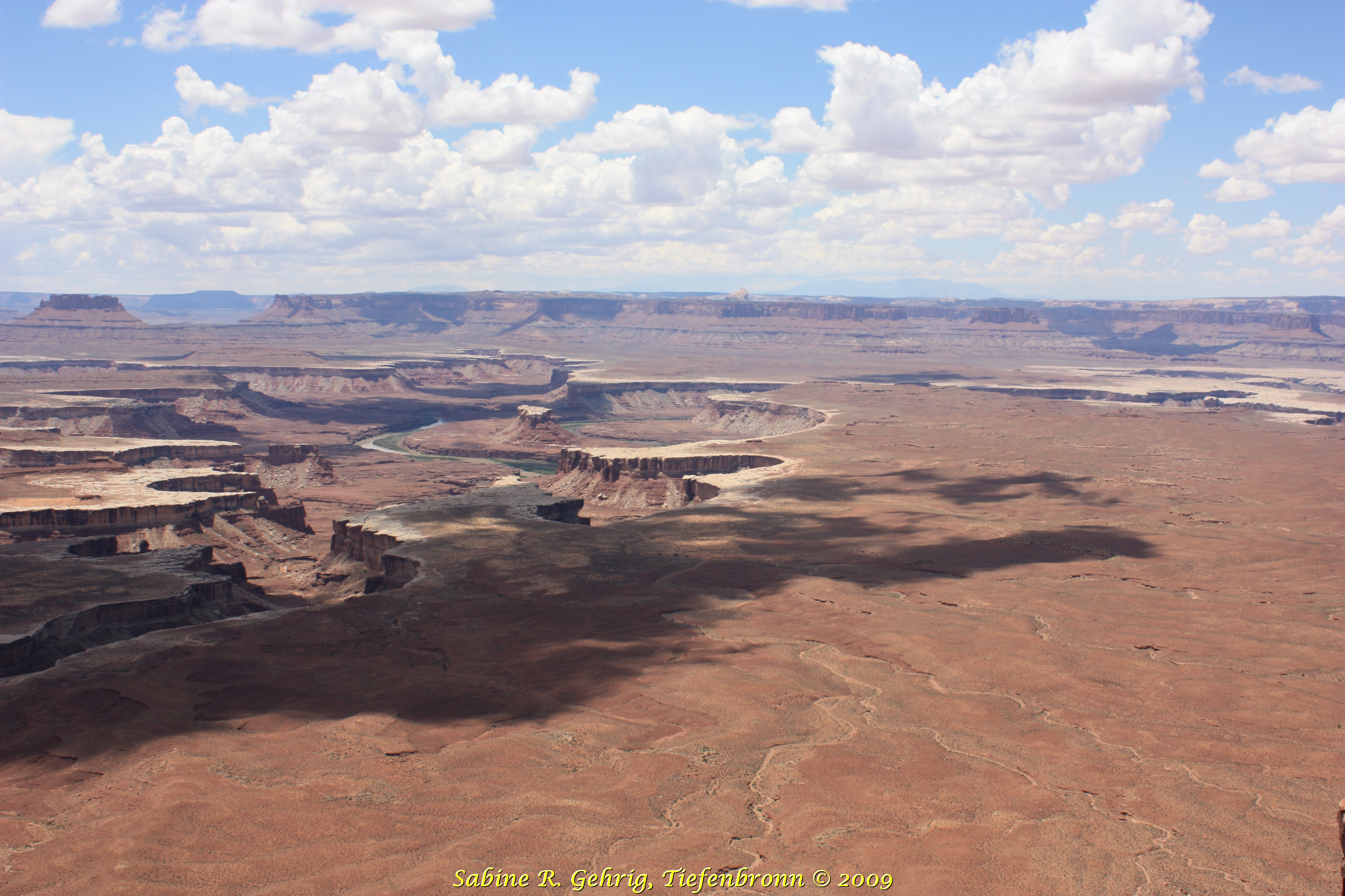
Canyonlands National Park, Island in the Sky, UT – Blick vom Green River Overlook Richtung Westen; im Nationalpark fließen der Green und Colorado River zusammen. / View from the Green River Overlook to the west; in the National Park the Green and Colorado River flow together.
Canyonlands National Park, Island in the Sky, UT – ein Blick in den inneren Canyon auf den Green River / a view of the Green River in the inner canyon
Canyonlands National Park, Island in the Sky, UT – Blick vom Green River Overlook Richtung Westen zu dem markanten Felsen ‚Cleopatras Stuhl‘ / View from the Green River Overlook to the west to the prominent rock ‚Cleopatras Chair’
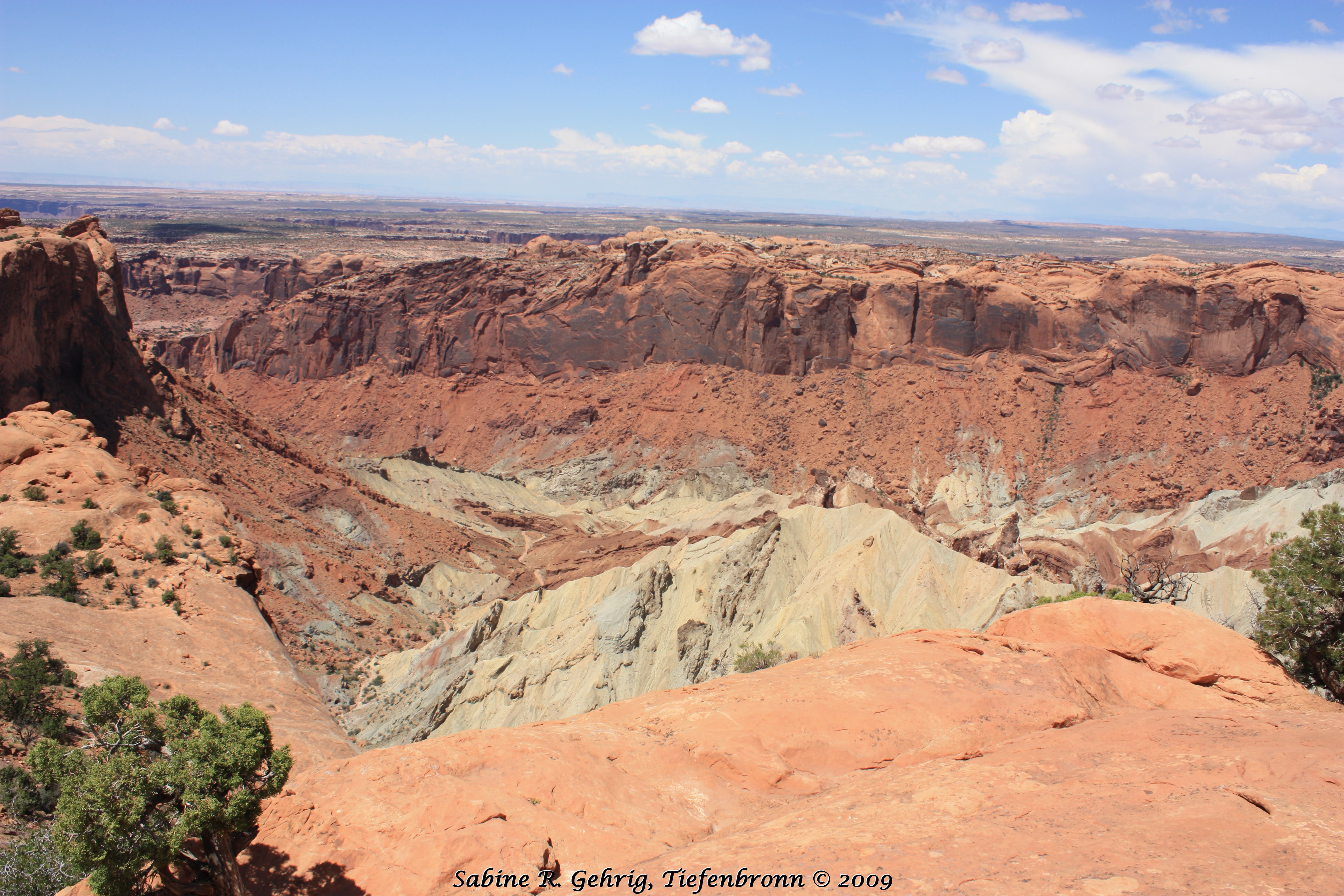
Canyonlands National Park, Island in the Sky, UT – Meteoritenkrater oder eingestürtzter Salzdom? Beim Upheaval Dome sind sich die Wissenschaftler nicht ganz einig. / Meteor crater or collapsed salt dome? Scientists do not quite agree on the Upheaval Dome.
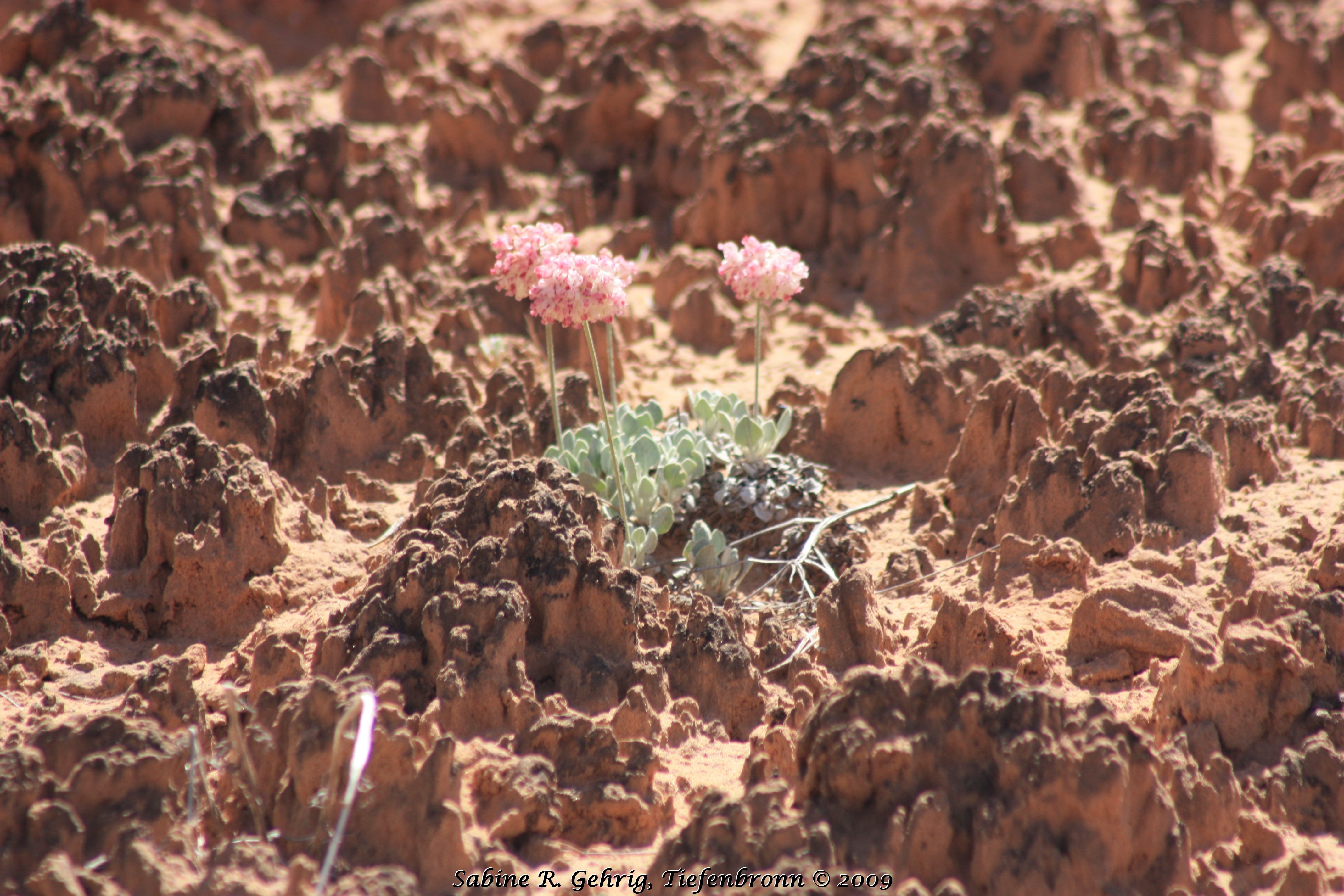
Canyonlands National Park, Island in the Sky, UT – Rosa Blümchen auf Cryptobiotic Soil, ein Boden, der nicht aus Erde besteht. Er ist ein komplexes, lebendes Bodensystem, das aus Cyanobakterien, Flechten, Algen, Pilzen und Moosen besteht und nur ganz langsam wächst. Deshalb – immer schön auf dem Weg bleiben! / Pink flowers growing on Cryptobiotic Soil, a soil that is not made of soil. It is a complex, living community consisting of cyanobacteria, lichens, algae, fungi and mosses that grows very slowly. Therefore – stay on the trail!
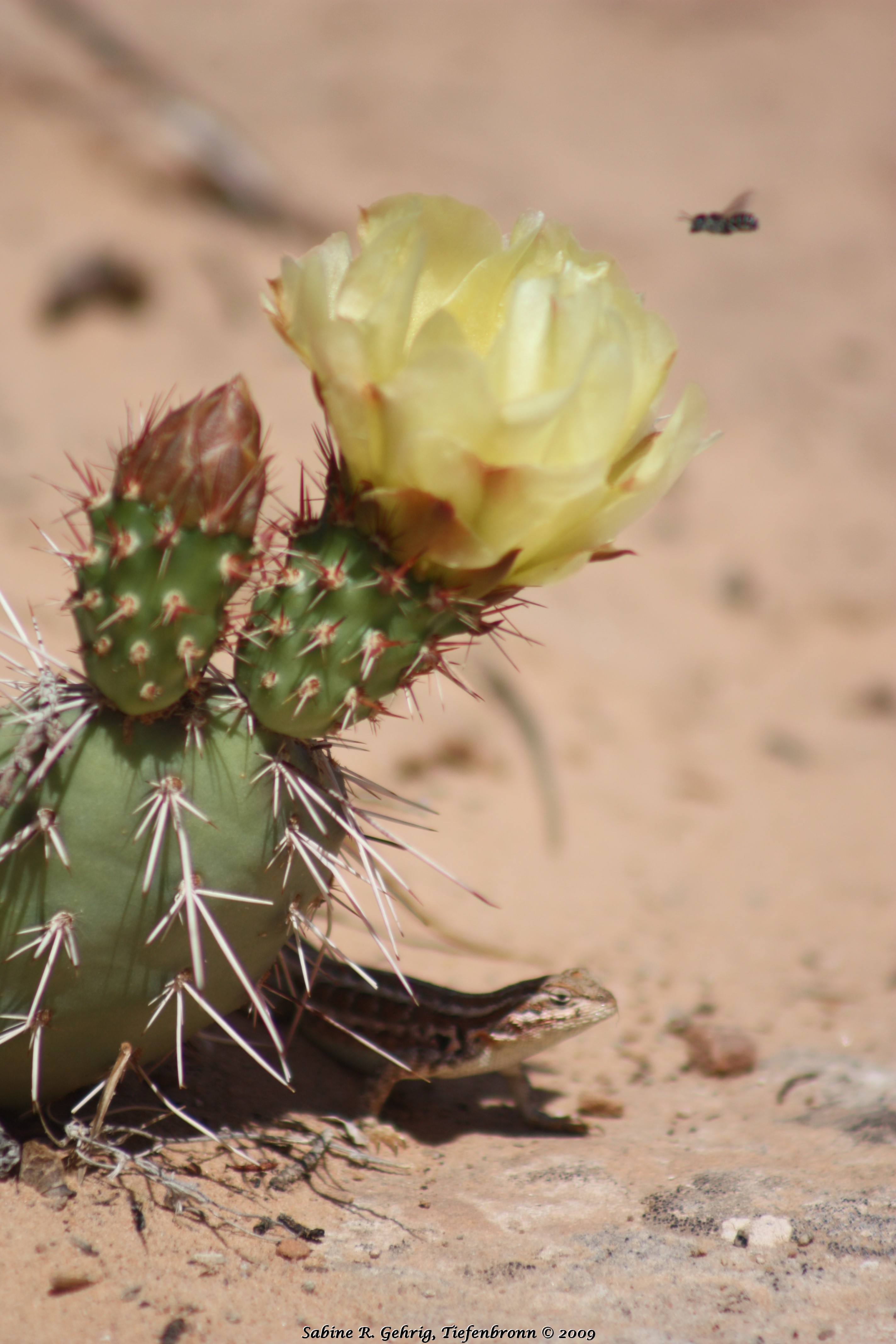
Canyonlands National Park, Island in the Sky, UT – gelbblühender Prickly Pear Cactus, in dessen Schatten eine Eidechse sitzt und eine Biene gerade im Anflug ist. / Prickly Pear Cactus with yellow flower, in the shade sits a lizard and a bee is just approaching the blossom
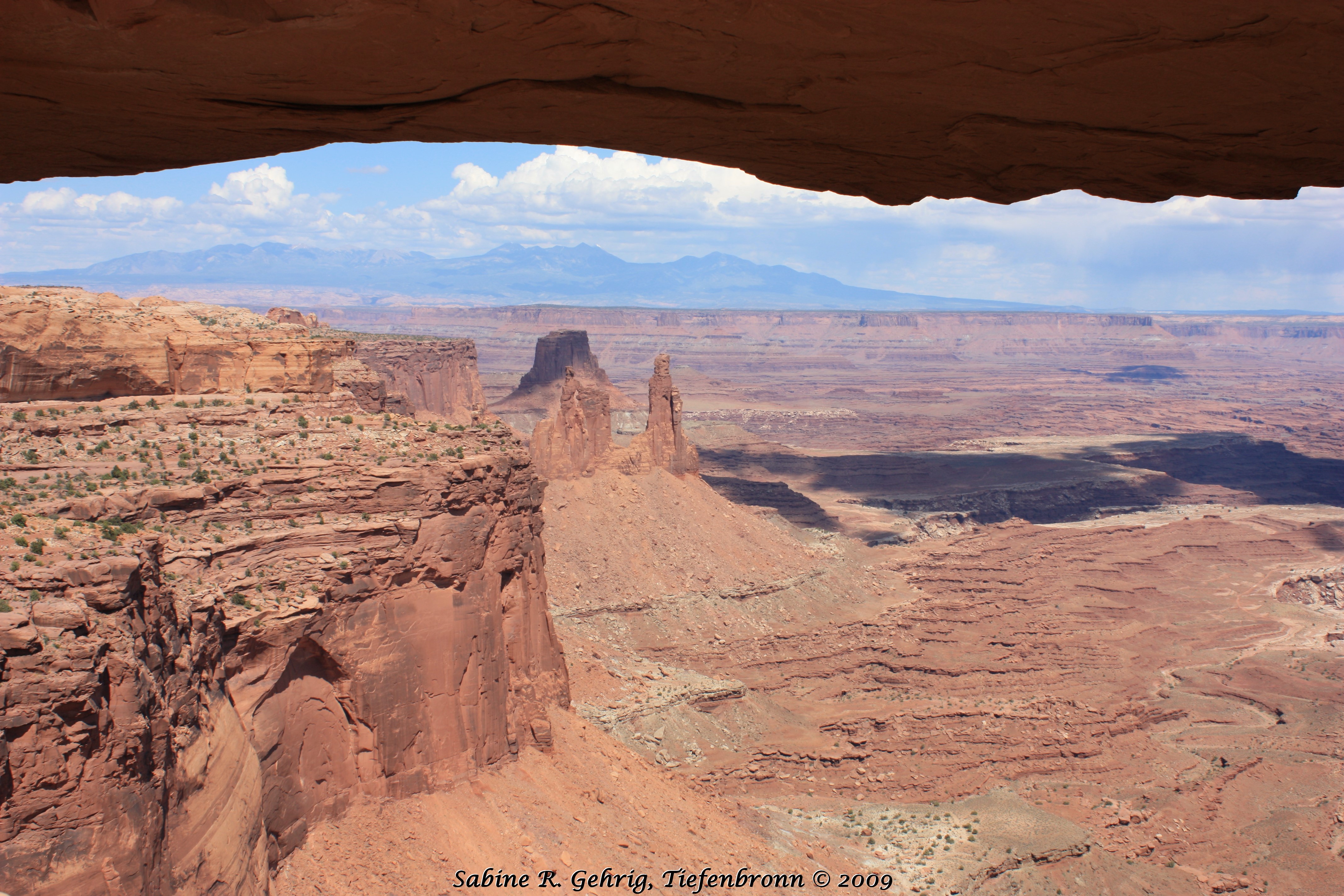
Canyonlands National Park, Island in the Sky, UT – Blick vom Mesa Arch, ein Felsbogen, der direkt an einer Felsklippe hängt, zu den La Sal Mountains / View from Mesa Arch, a so called cliff-hanging arch, to the La Sal Mountains
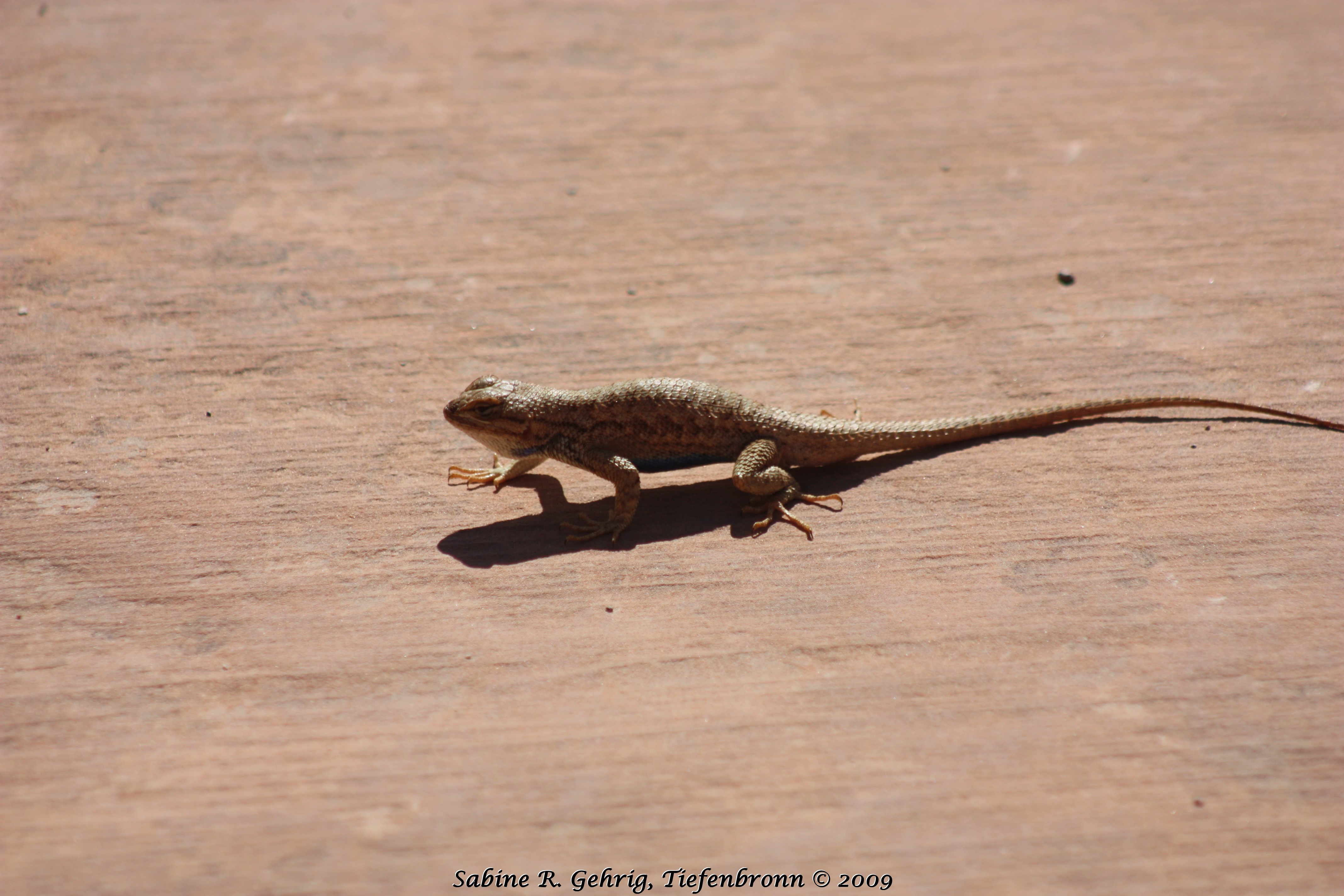
Canyonlands National Park, Island in the Sky, UT – Eine Eidechse / a lizzard
Great Job!
I wish I would’ve driven the Shafer Trail Road when I was there…maybe next time!
Jerry